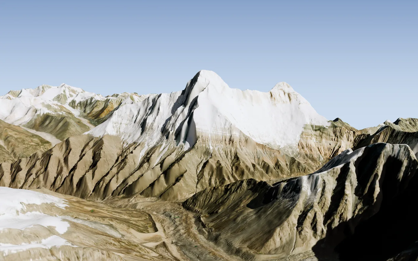
 Nanda Devi7,816 m
No. 10 · Nanda Devi, Uttarakhand · 5 October 2026
Where is the generator lost on Nanda Devi in 1965?
A plutonium-powered generator was tied to a ledge near 7,200 m in October 1965. By spring the ledge was gone. Twelve pictures on where sixty-one years of gravity and ice have most likely put it.
Rendered view, not a photograph · Esri World Imagery (Esri, Vantor) · captured 15 September 2018, over terrain from the High Mountain Asia 8 m DEMs and Copernicus DEM GLO-30 · from the south-west · heights not exaggerated
03 / 12 · the camp
The ridge
The route was the south ridge, first climbed in 1936. The fourth camp sat in “a small rocky depression” used by every party before, about 600 m below the summit.
The 1965 party’s own figures put it at 7,224 to 7,239 m; other parties give 7,010 to 7,163 m for the same site. On the crest that is a stretch of 330 m, marked white.
Rendered view, not a photograph · Esri World Imagery (Esri, Vantor) · captured 15 September 2018, over terrain from the High Mountain Asia 8 m DEMs and Copernicus DEM GLO-30 · from the west-south-west · heights not exaggerated
Esri World Imagery (Esri, Vantor) · High Mountain Asia 8 m DEMs (Shean 2017, NSIDC) · Copernicus DEM GLO-30 · Tilman 1937 · Report of the Committee of Scientists, 1979 · Kohli and Conboy, Spies in the Himalayas (2003)
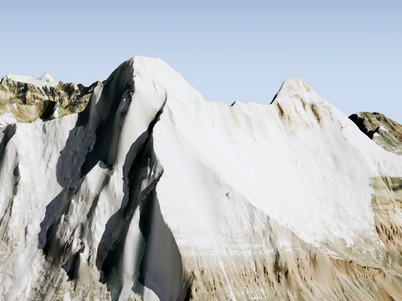 Summit7,816 mFourth camp7,010 to 7,239 mSouth ridge
04 / 12 · what was found
Spring 1966: the shelf is gone
“The rock shelf where he had left the boxes was completely gone, as if a massive knife had surgically severed that one corner of the slope.”Kohli and Conboy, Spies in the Himalayas (2003)
The official account says the same: “the entire rock where these things were kept seemed to have broken”. A climber and four Sherpas reached the camp on 1 June 1966. A collapsed tent, a gas canister, a radio and lengths of wire were there. The generator and the rock it was tied to were not.
Drawn from the accounts; not to scale, and the shape of the ledge is not known · inset: rendered view, not a photograph · Esri World Imagery (Esri, Vantor) · captured 15 September 2018, over terrain from the High Mountain Asia 8 m DEMs and Copernicus DEM GLO-30
Kohli and Conboy, Spies in the Himalayas (2003) · Report of the Committee of Scientists, 1979, Annexure 3 · inset: Esri World Imagery (Esri, Vantor) · High Mountain Asia 8 m DEMs (Shean 2017, NSIDC) · Copernicus DEM GLO-30
05 / 12 · gravity
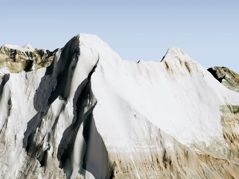
Two ways down, and a third
A camp on a crest can lose a load down either side. West of the crest the ground sends a fall south-south-west onto the glacier, up to a crest height of 7,322 m; higher than that it goes west. East of the crest everything runs to the glacier’s head, out of sight behind the ridge.
Rendered view, not a photograph · Esri World Imagery (Esri, Vantor) · captured 15 September 2018, over terrain from the High Mountain Asia 8 m DEMs and Copernicus DEM GLO-30 · from the south-west · heights not exaggerated · paths: steepest descent with an avalanche runout rule; dashed where ground stands in front
Esri World Imagery (Esri, Vantor) · High Mountain Asia 8 m DEMs (Shean 2017, NSIDC) · Copernicus DEM GLO-30
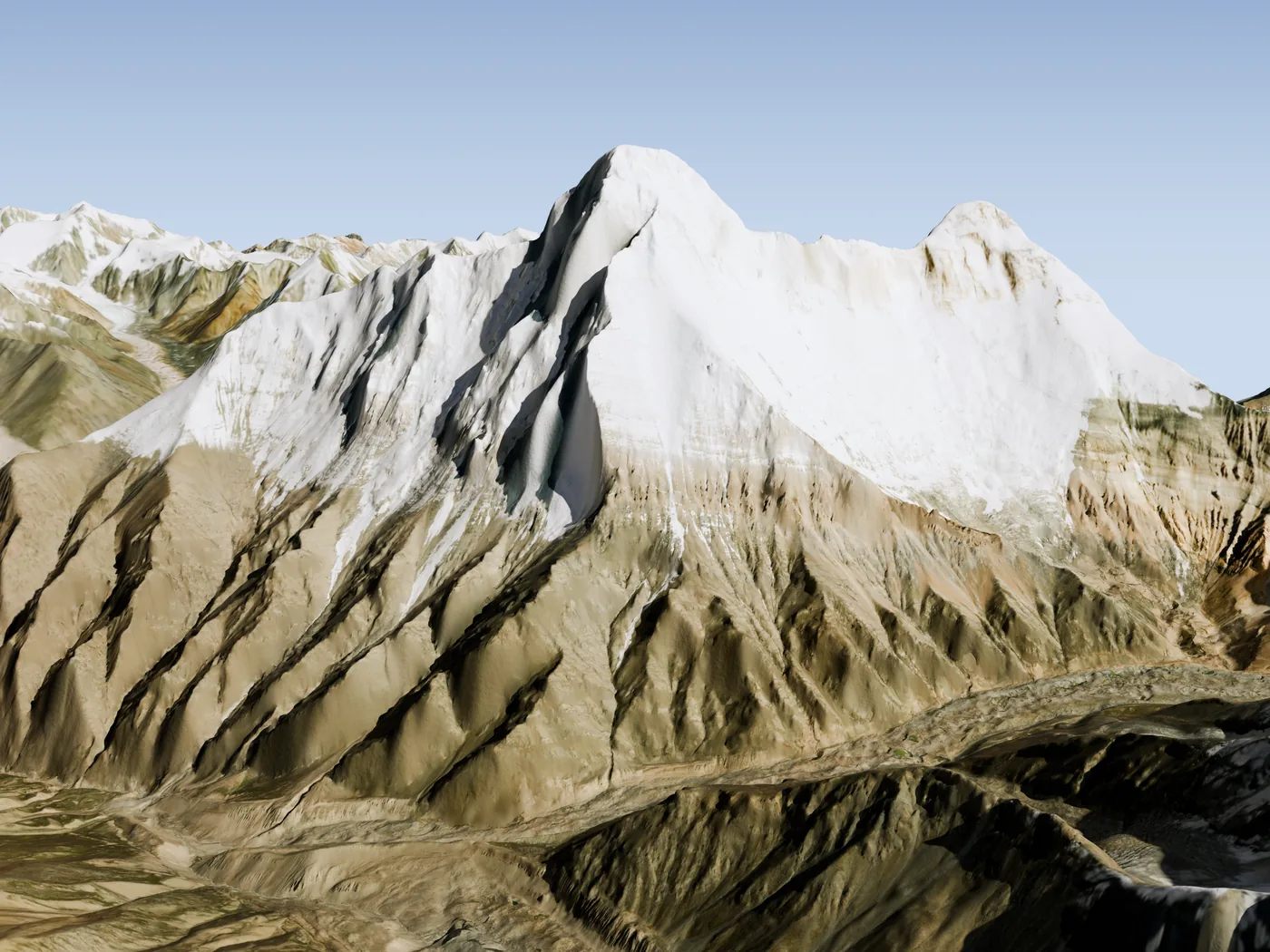 Fourth camponto the glacierto the valley floor
06 / 12 · evidence
The test few remember
On 8 June 1966 the search party dropped a part-used gas cylinder from the camp. It was found “in the glacier just on the way between the sanctuary and base camp”. Only the south-south-west fall ends there.
Rendered view, not a photograph · Esri World Imagery (Esri, Vantor) · captured 15 September 2018, over terrain from the High Mountain Asia 8 m DEMs and Copernicus DEM GLO-30 · from the south-west · heights not exaggerated
Report of the Committee of Scientists, 1979, Annexure 3, p. 18 · Esri World Imagery (Esri, Vantor) · High Mountain Asia 8 m DEMs (Shean 2017, NSIDC) · Copernicus DEM GLO-30
Dropped here8 June 1966Found on the glacier08 / 12 · sixty-one years
The ice barely moves
Satellites have timed this glacier since the 1980s: 18.6 m a year above the bend, 7.6 under the face, 3.2 on the lower tongue.
Anything that landed on the ice under the face has travelled about 203 m between 1965 and 2026. Across the runs, 22 to 539 m.
Rendered view, not a photograph · Esri World Imagery (Esri, Vantor) · captured 15 September 2018, over terrain from the High Mountain Asia 8 m DEMs and Copernicus DEM GLO-30 · from the south-west, across the glacier · heights not exaggerated · white band: where a fall from the camp reaches the ice · ice speed: 120 m grid, all years
ITS_LIVE v2.1 (NASA MEaSUREs) · Esri World Imagery (Esri, Vantor) · High Mountain Asia 8 m DEMs (Shean 2017, NSIDC) · Copernicus DEM GLO-30
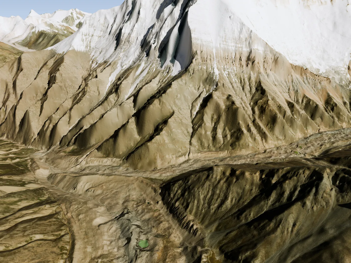 3 km4 km5 km6 kmice stops moving1965 → 2026
09 / 12 · the answer, as far as it goes
Where that leaves it
Most likely in or under the lower glacier, 4.5 to 5.4 km down its centreline. About 7 runs in ten end here; the rest stop higher, on the face or in the gullies searched in 1966–68, or on the other sides.
The generator gave 800 W of heat in 1965 and about 490 W now: on ice it melts its way to the bed. The ice stops moving 1.3 to 2.2 km further on. At its present pace that is five centuries or more away.
Esri World Imagery (Esri, Vantor) · captured 15 September 2018 · 0.5 m source, shown at 1.25 m to the pixel · north up
Esri World Imagery (Esri, Vantor) · ITS_LIVE v2.1 (NASA MEaSUREs) · Report of the Committee of Scientists, 1979, Annexure 7
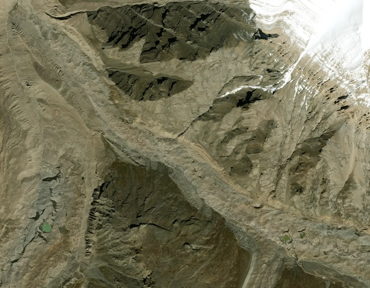 3 km4 km5 km6 kmMost likely hereat the bed of the iceice stops movingthe fall comes down here
10 / 12 · downstream
What flows from here
The glacier’s water leaves the Sanctuary as the Rishi Ganga, joins the Dhauliganga just below Reni, and the Dhauliganga joins the Alaknanda at Vishnuprayag. At Devprayag the Alaknanda meets the Bhagirathi and becomes the Ganga.
By ice, anything in the tongue is centuries from its end. By water under the ice it could be one melt season, if a channel connects. Nobody has measured the drainage under a debris-covered Himalayan glacier.
- glacier
- Rishi Ganga
- Dhauliganga
- Alaknanda
- Ganga
Rendered view, not a photograph · Esri World Imagery (Esri, Vantor) · captured 15 September 2018, over terrain from the High Mountain Asia 8 m DEMs and Copernicus DEM GLO-30 · from the south-east, looking down the gorge · heights not exaggerated · rivers as mapped in OpenStreetMap; dashed where a ridge stands in front
© OpenStreetMap contributors · Chamoli district, Government of Uttarakhand · Report of the Committee of Scientists, 1979, Annexure 7 · Esri World Imagery (Esri, Vantor) · High Mountain Asia 8 m DEMs (Shean 2017, NSIDC) · Copernicus DEM GLO-30 · Miles and others 2017
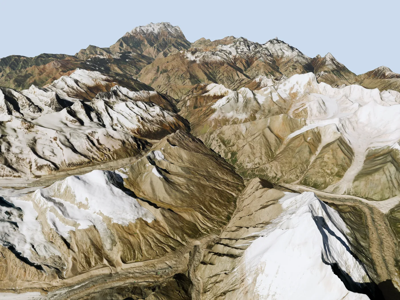 Nanda Devithe glacierRishi GangaRenijoins the DhauligangaVishnuprayagjoins the Alaknanda
12 / 12 · limits, method, sources
What we cannot say
- Which side of the crest the loads sat on. No account says so outright.
- Whether it broke up. The 1979 report lists six possible fates; none is ruled out here.
- Anything about dose. No satellite sees the object or its radiation. This is about place.
- The shares are not measured odds. They lay out what the ground and the record allow.
How it was made. The camp was placed on the ridge from the expedition accounts and the 1979 report. Falls were run downhill from it on 30 m and 8 m elevation models and stopped by a published avalanche runout rule. What reached the ice was moved for 61 years at the speeds satellites measure. The 1966 drop test was then weighed in.
- Report of the Committee of Scientists on the Nanda Devi nuclear device, laid in the Lok Sabha 18 May 1979
- Prime Minister’s statement, Lok Sabha, 17 April 1978
- M. S. Kohli and K. Conboy, Spies in the Himalayas, University Press of Kansas, 2003
- H. W. Tilman, The Ascent of Nanda Devi, Himalayan Journal 9, 1937
- N. Kumar, Nanda Devi 1964, Himalayan Journal 25
- M. Clarke, Nanda Devi via the South Ridge, Himalayan Journal 36
- M. S. Kohli, Indian Police Journal, October–December 2012
- Esri World Imagery (Esri, Vantor): WorldView-2, captured 15 September 2018, 0.5 m
- Copernicus DEM GLO-30
- Shean, D. (2017), High Mountain Asia 8-meter DEMs derived from along-track and cross-track optical imagery, Version 1, NASA NSIDC DAAC, doi:10.5067/GSACB044M4PK and doi:10.5067/0MCWJJH5ABYO
- ITS_LIVE regional glacier velocity mosaics v2.1, NASA MEaSUREs (Gardner and others 2025)
- Lied and Bakkehøi 1980, Journal of Glaciology 26 (the runout rule)
- Rivers: © OpenStreetMap contributors, Open Database Licence
- Chamoli district website, Government of Uttarakhand: Geography, river system (the confluences)
- Miles and others 2017, The hydrology of debris-covered glaciers, The Cryosphere Discussions
- New Indian Express, 17 February 2021 (the information request)
Esri World Imagery (Esri, Vantor) · captured 15 September 2018 · 0.5 m source, shown at 1.5 m to the pixel · north up · orange: the fall to the south-south-west · ring: where a fall to the west would come to rest, by the runout rule
Maplore Gazette · counted and drawn by Maplore
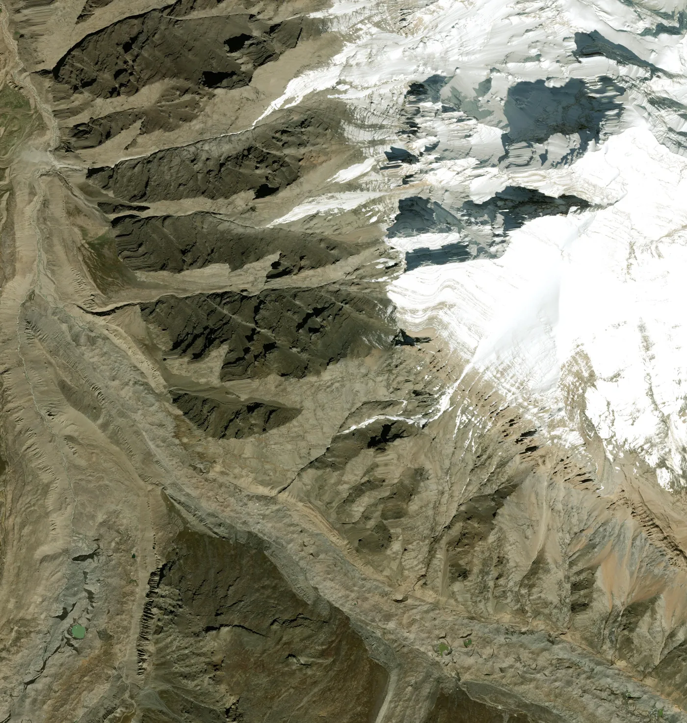 Nanda DeviFourth campmost likely herea west fall would end hereon the valley floorice stops moving