Ten places that matter to India this season, each answered with one number read from open satellite passes, radar or optical, the pictures behind it, and what the number cannot say.Newest pass 24 October 2026 · Copernicus Sentinel-1 and Sentinel-2, 10 m · counted by Maplore
Bright is hard.Steel, concrete and wet mud throw the radar pulse back. A ship is a white point.
Black is calm water.Still sea, brine and smooth ground send the pulse away. Wind roughens water to grey.
A ring is a hull we counted.Same place, same track, same rule on every pass, so the numbers compare.
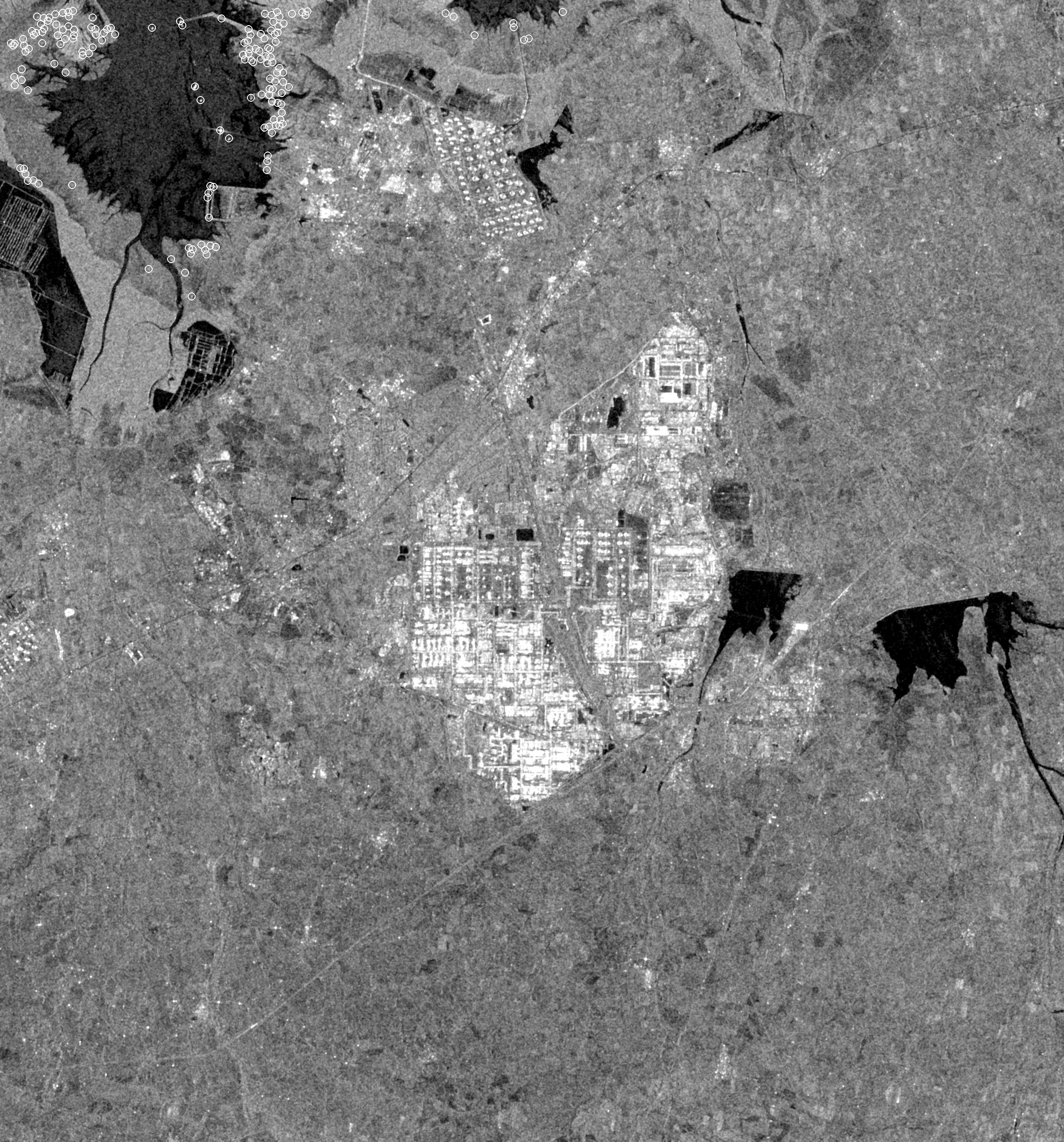
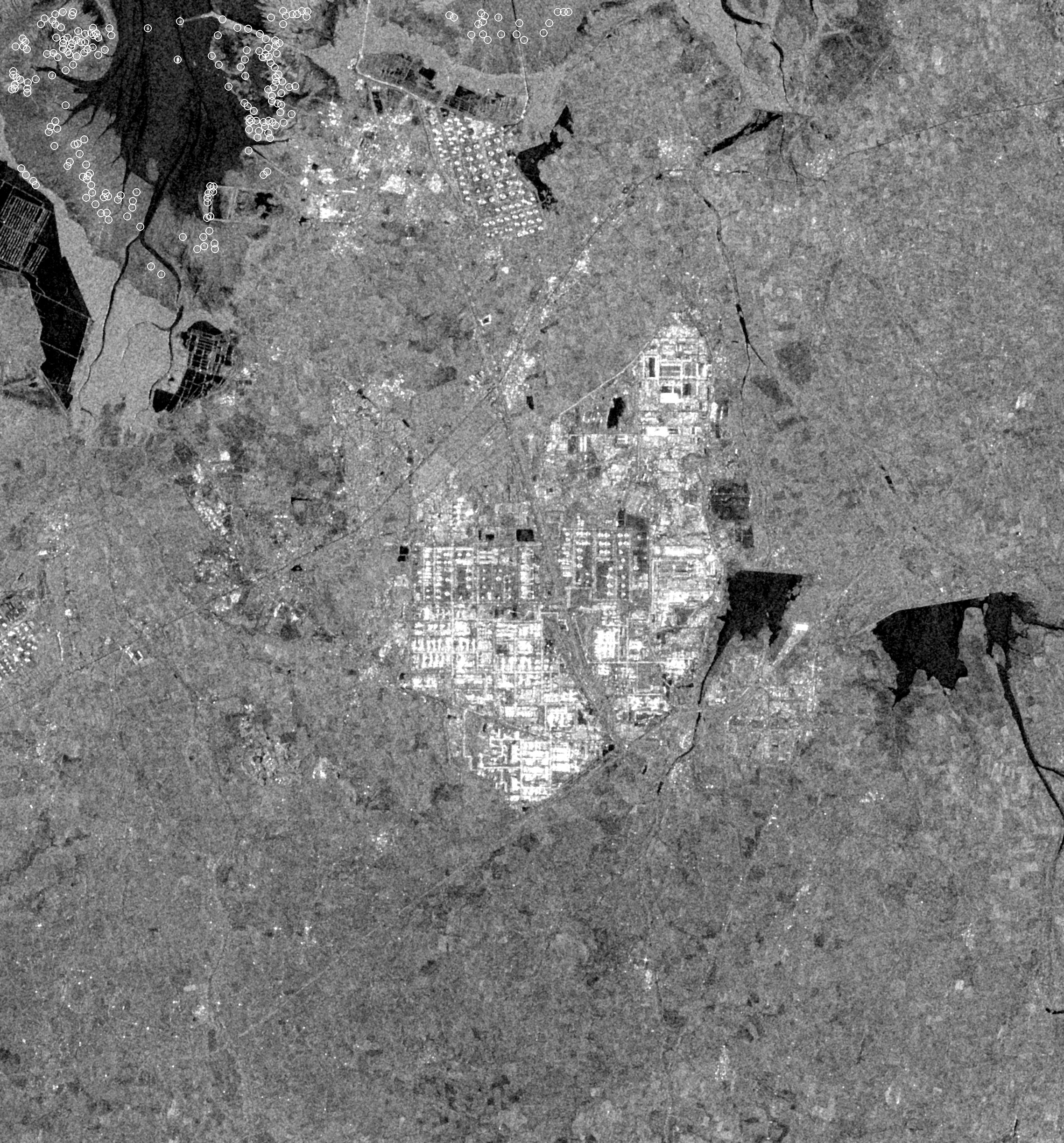
No. 5 · Strait of Hormuz · Sentinel-1 · 10 m · track 166 · 21 October 2026 · 02:14 UTC
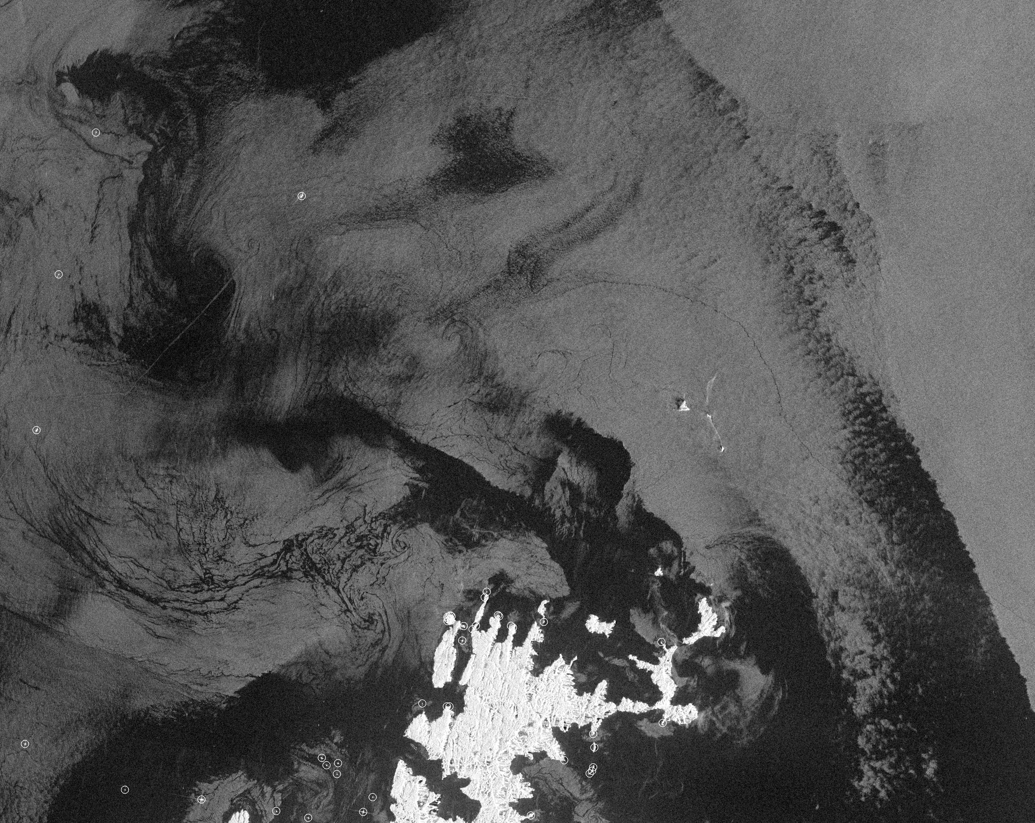
Is anything moving through Hormuz?
40 hulls in the frame on 21 October. The same frame, same track, held 72 on 22 February, the last week before the closure, and 44 a year ago.
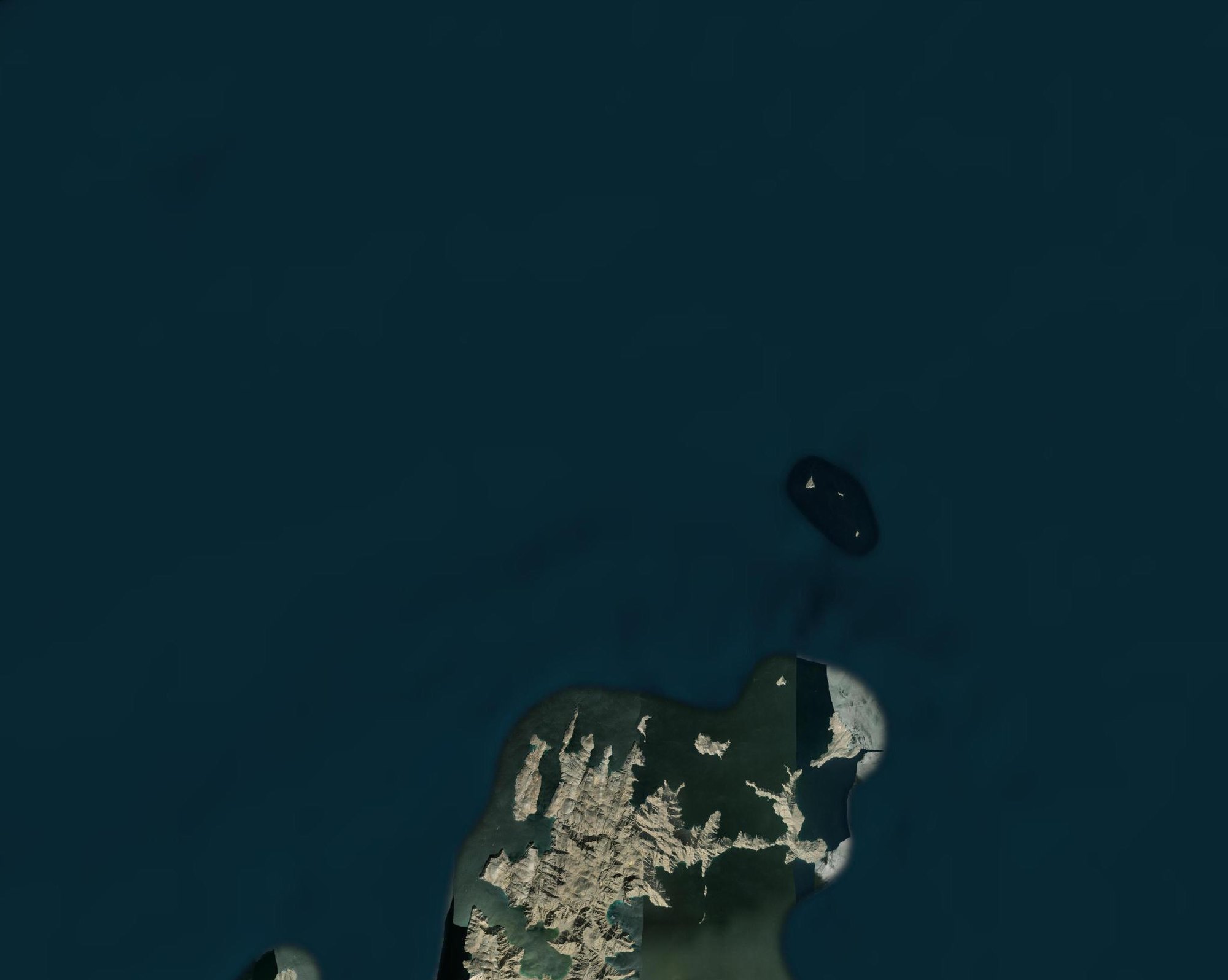
What is here · optical, Esri World Imagery (Esri, Maxar) · same frame as the radar · orientation only
solid: track 166, the frame above · hollow: other tracks, which see a different slice of the strait and are not compared
Radar needs no transponder: every hull returns the pulse, broadcasting or dark. It cannot say what a hull carries or where it is bound. IMF PortWatch counted 1 to 5 transits a day for 21–27 September, against 95 a day a year ago.
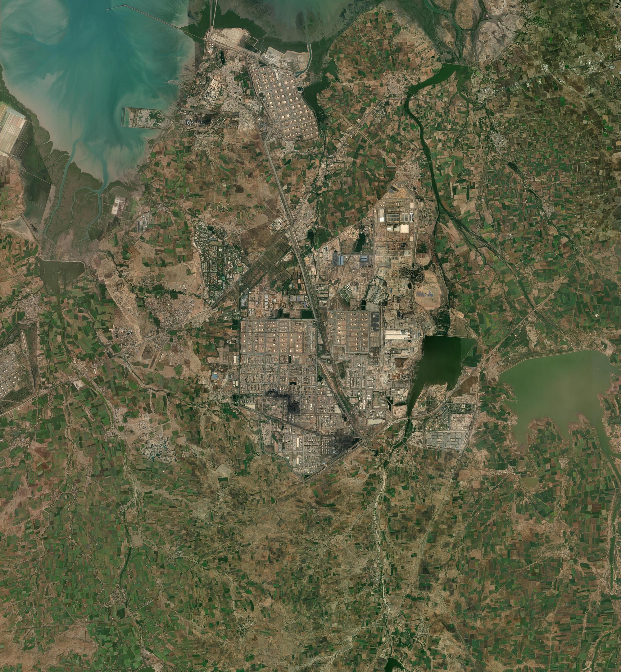
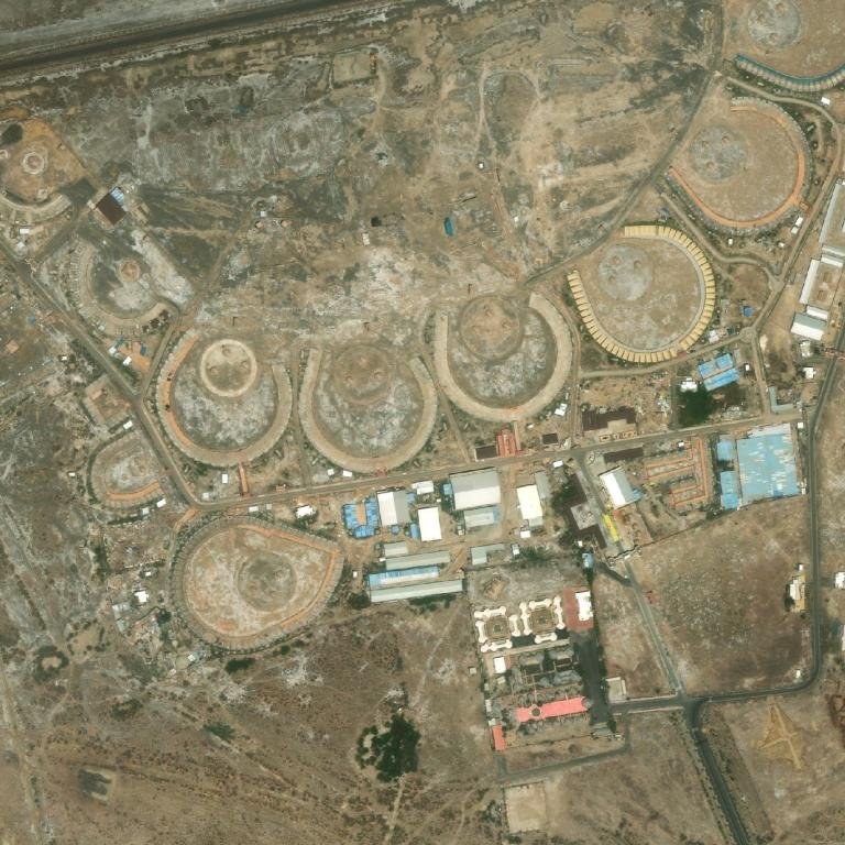
Detail: the tank farm at 0.5 mICEYE dwell · 8 Nov 2025 · CC BY 4.0
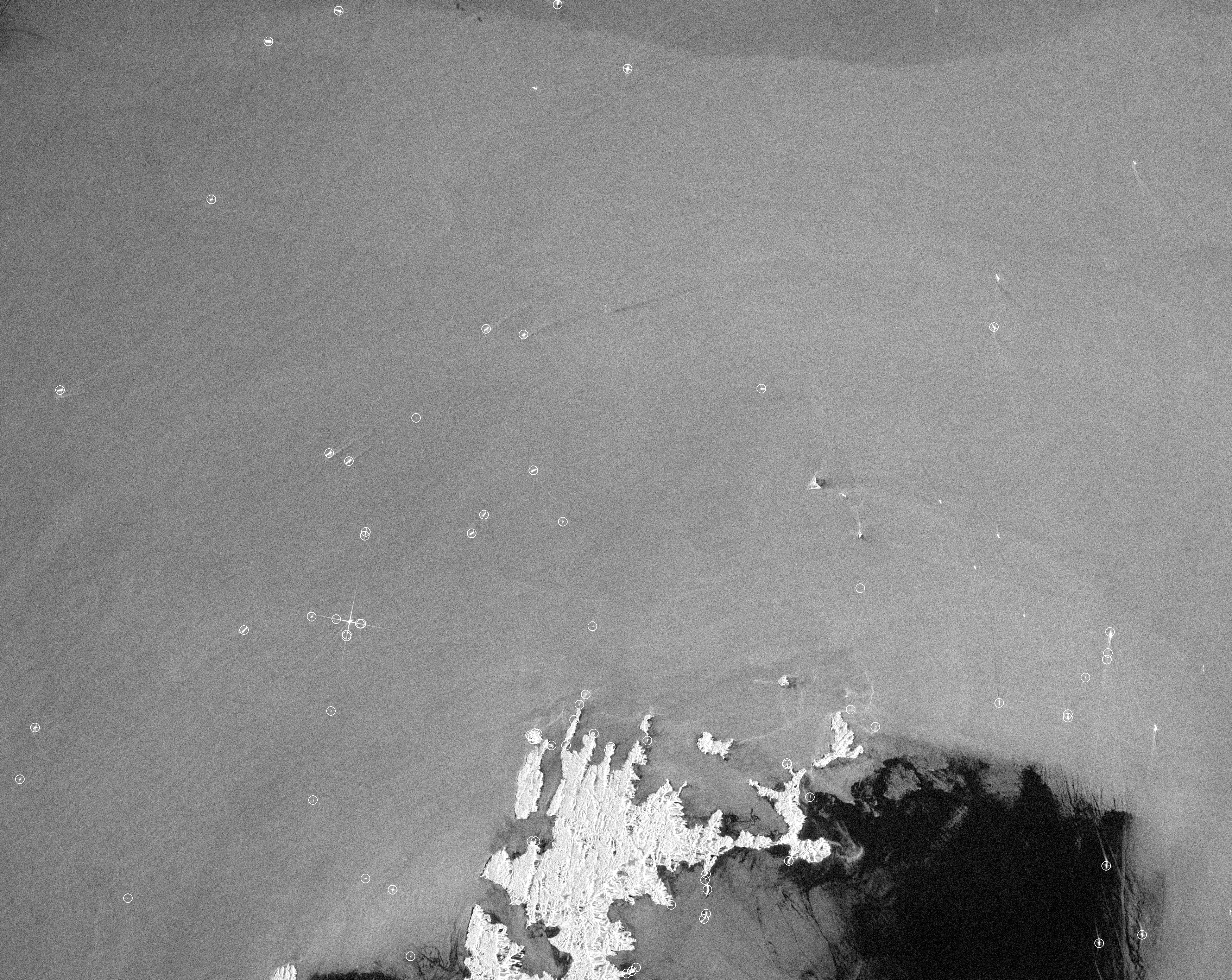
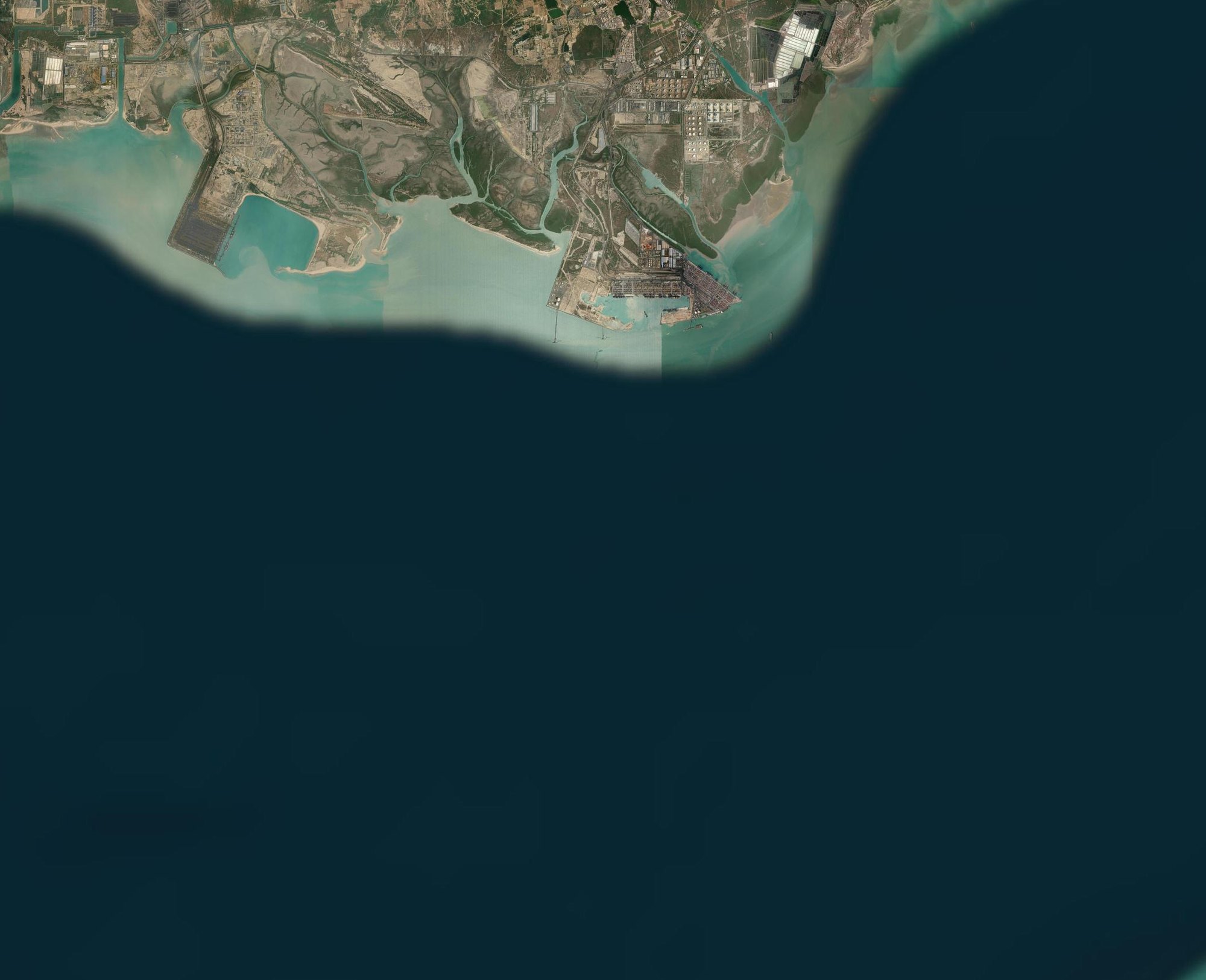
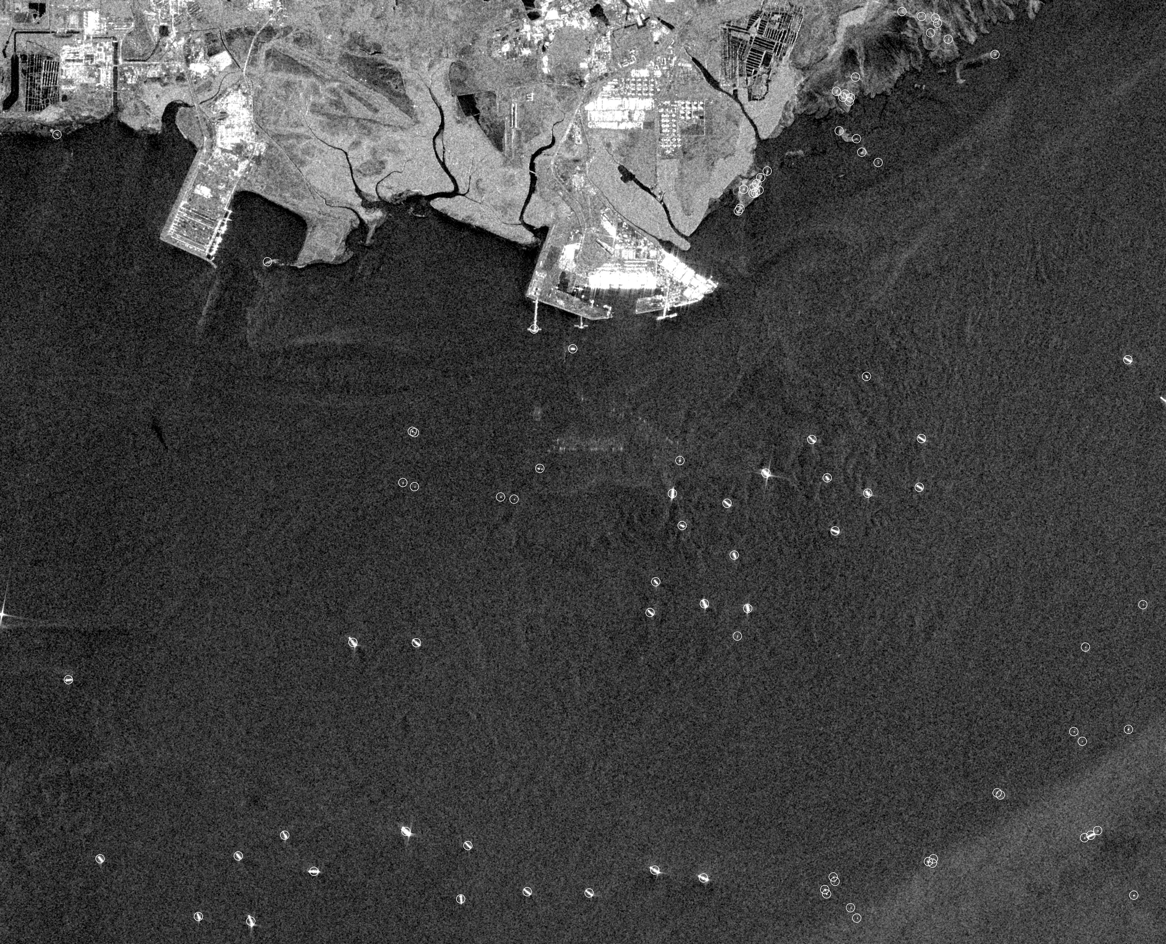
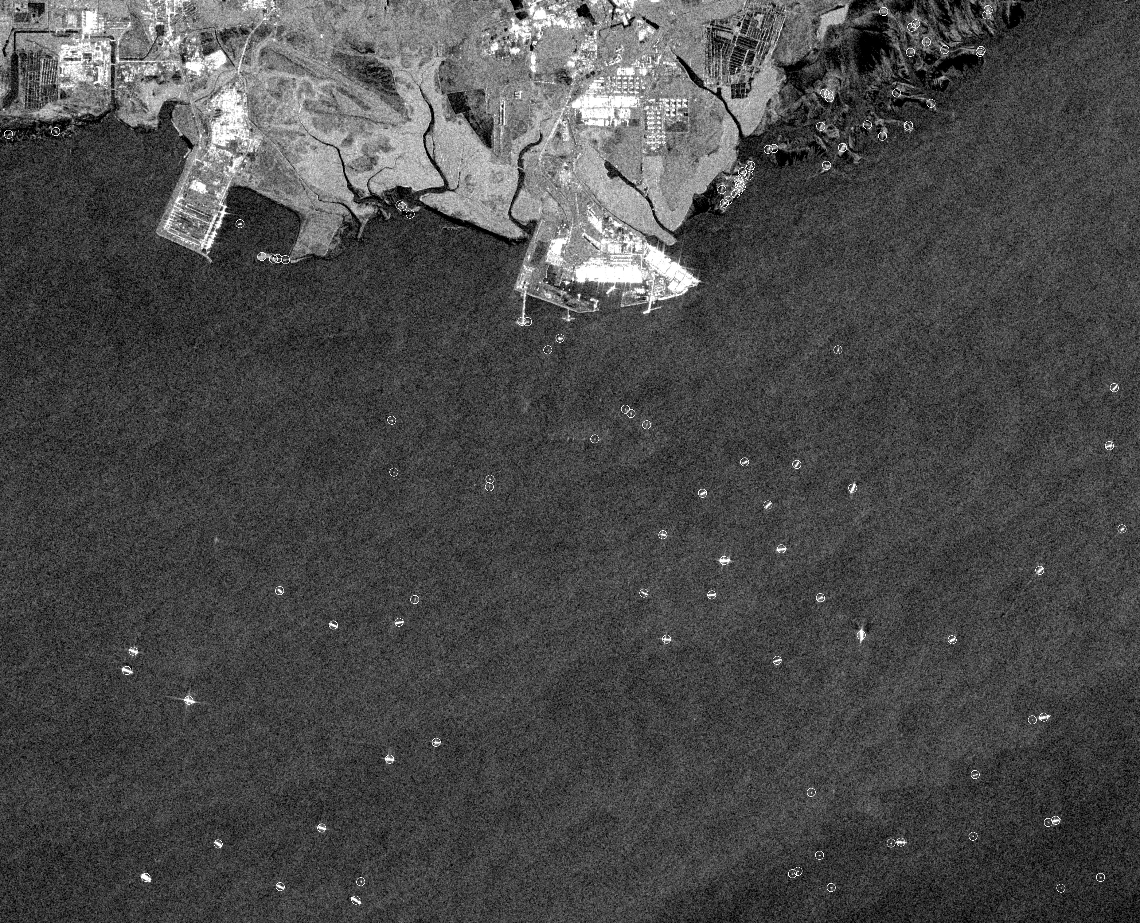
No. 3 · Mundra, Gujarat · Sentinel-1 · 10 m · track 5 · 22 October 2026 · 06:48 IST
How busy is Mundra?
81 hulls on the water on 22 October; 30 of them waiting more than 3 km offshore. 96 on 10 October, on the same track.
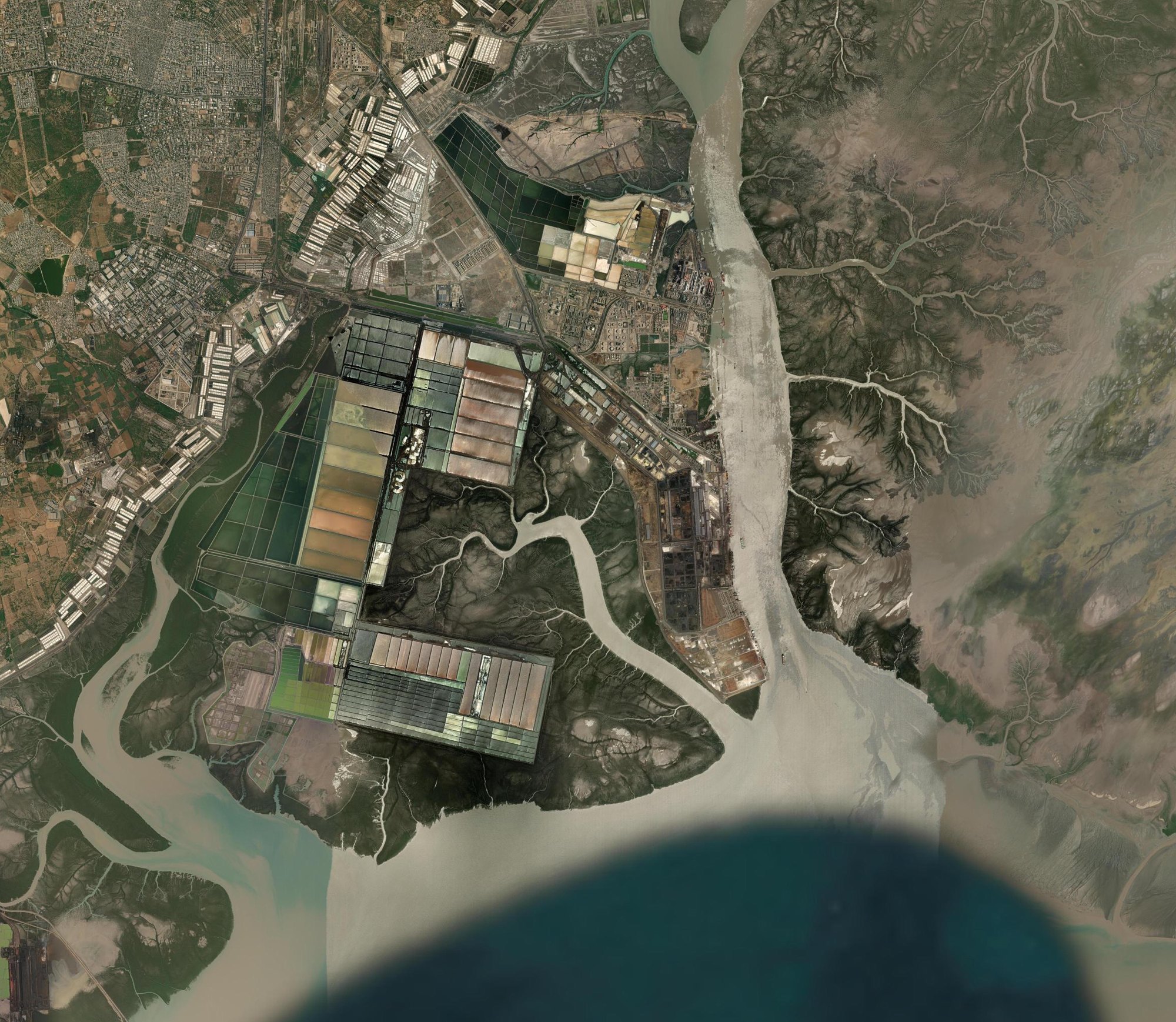
What is here · optical, Esri World Imagery (Esri, Maxar) · same frame as the radar · orientation only
all four passes on track 5, so all four compare
A ship alongside a berth merges with the quay in radar, so the count is a floor. The anchorage count is the cleaner number: open water, nothing to merge with.
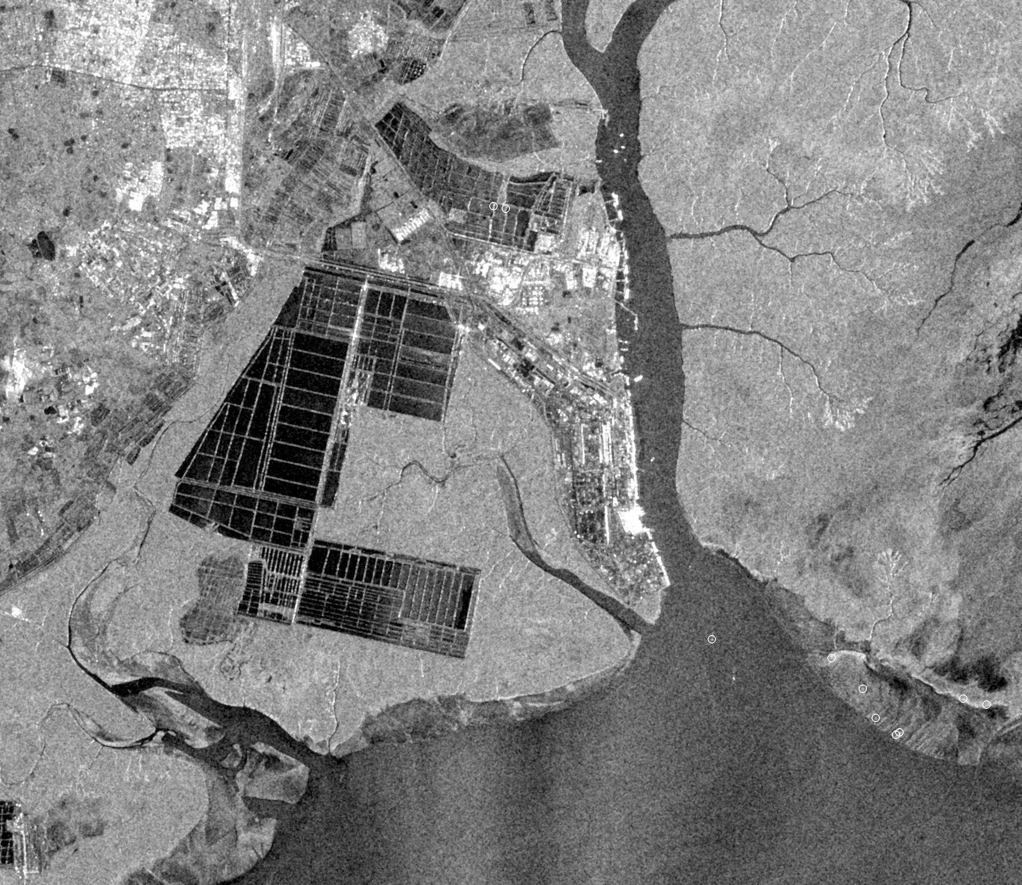
No. 4 · Kandla, Gujarat · Sentinel-1 · 10 m · track 5 · 22 October 2026 · 06:48 IST
How many ships are in Kandla creek?
9 we can separate from the quay on 22 October. Kandla is a creek port: ships lie alongside, hull and berth merge in radar, and the number is a floor, not a count. The same track showed 8 on 10 October.
What is here · optical, Esri World Imagery (Esri, Maxar) · same frame as the radar · orientation only
solid: track 5 · hollow: track 107, not compared
160 million tonnes of cargo passed here in 2025-26, the most of any Major Port. No open high-resolution frame of Kandla exists; one can be bought.
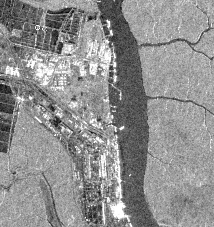
Detail: the berths, same frameSentinel-1 · 10 m · 22 Oct 2026
No. 2 · Khavda, Kachchh · Sentinel-1 · 10 m · track 5 · 22 October 2026 · 06:47 IST
How much of Khavda got built in a year?
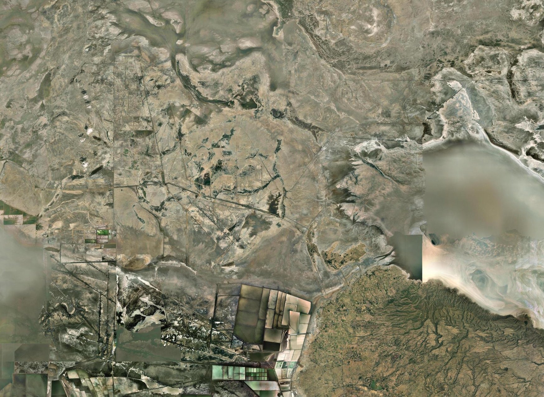
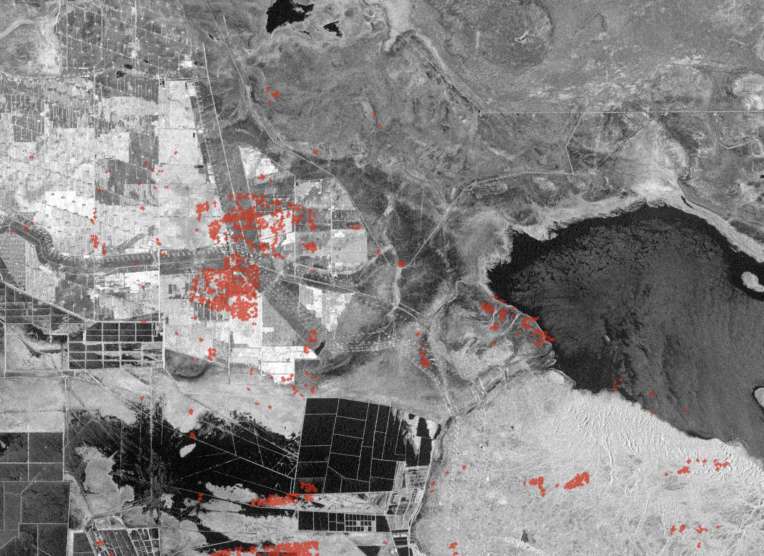
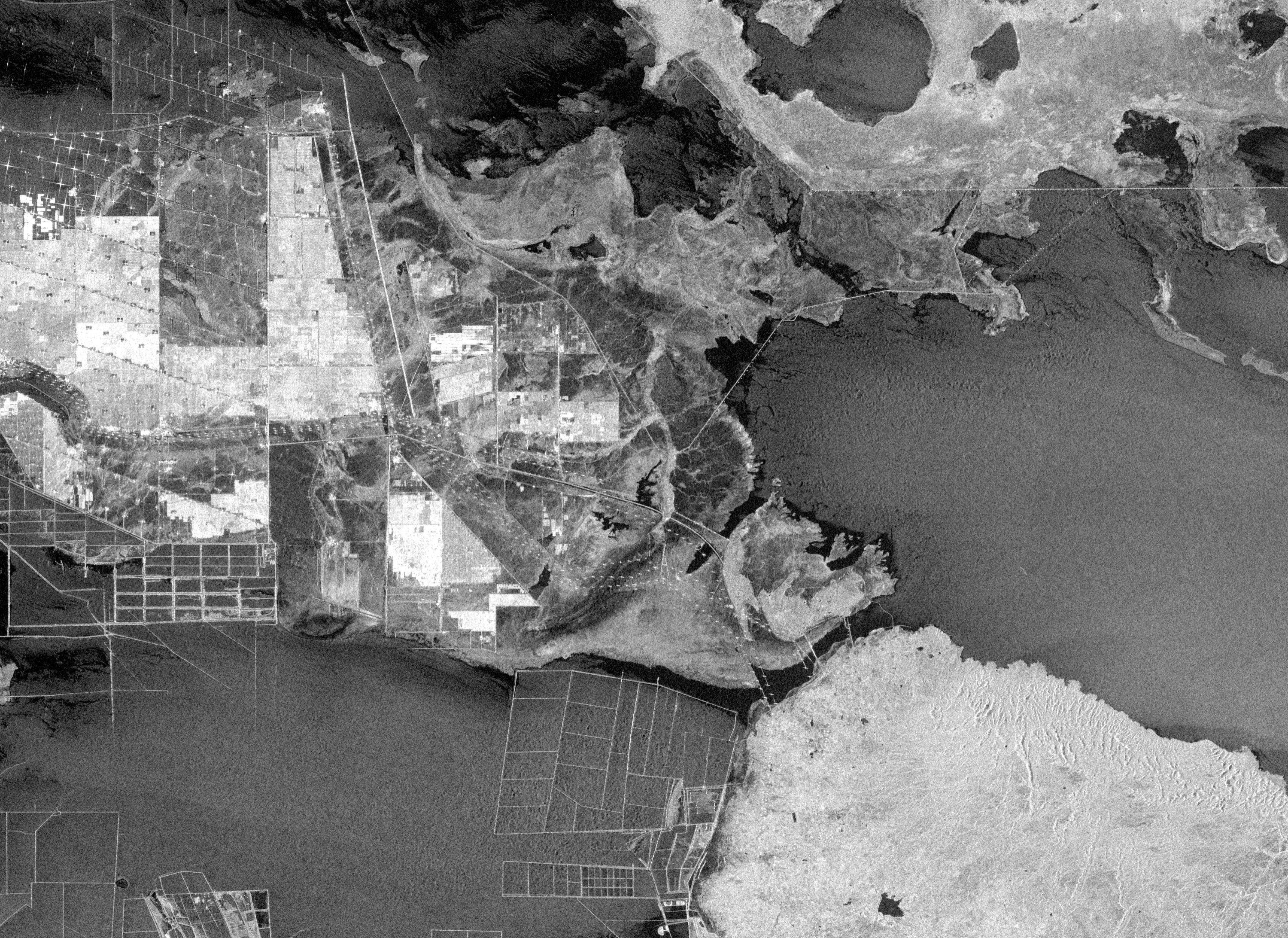
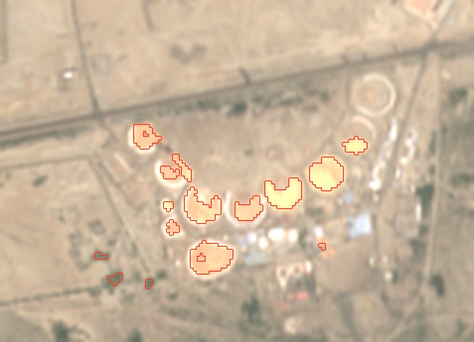
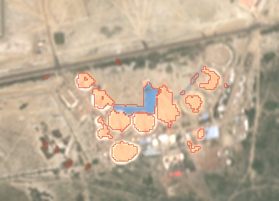
26.1 km² of ground that was bare land on 8 October 2025 now returns the pulse like steel and concrete: frames, substations, roads. The park is planned at 538 km²; 9.4 GW was running by 31 March 2026 of 30 GW by 2029. The red along the lake shore is drying, not building.
What is here · optical, Esri World Imagery (Esri, Maxar) · same frame as the radar · orientation only
the six largest new patches, numbered on the frame33.5 km² in all
Newly bright means hard and new; radar does not say whether a block is panels, a substation or a yard. A patch beside the Rann may be shore drying rather than building.
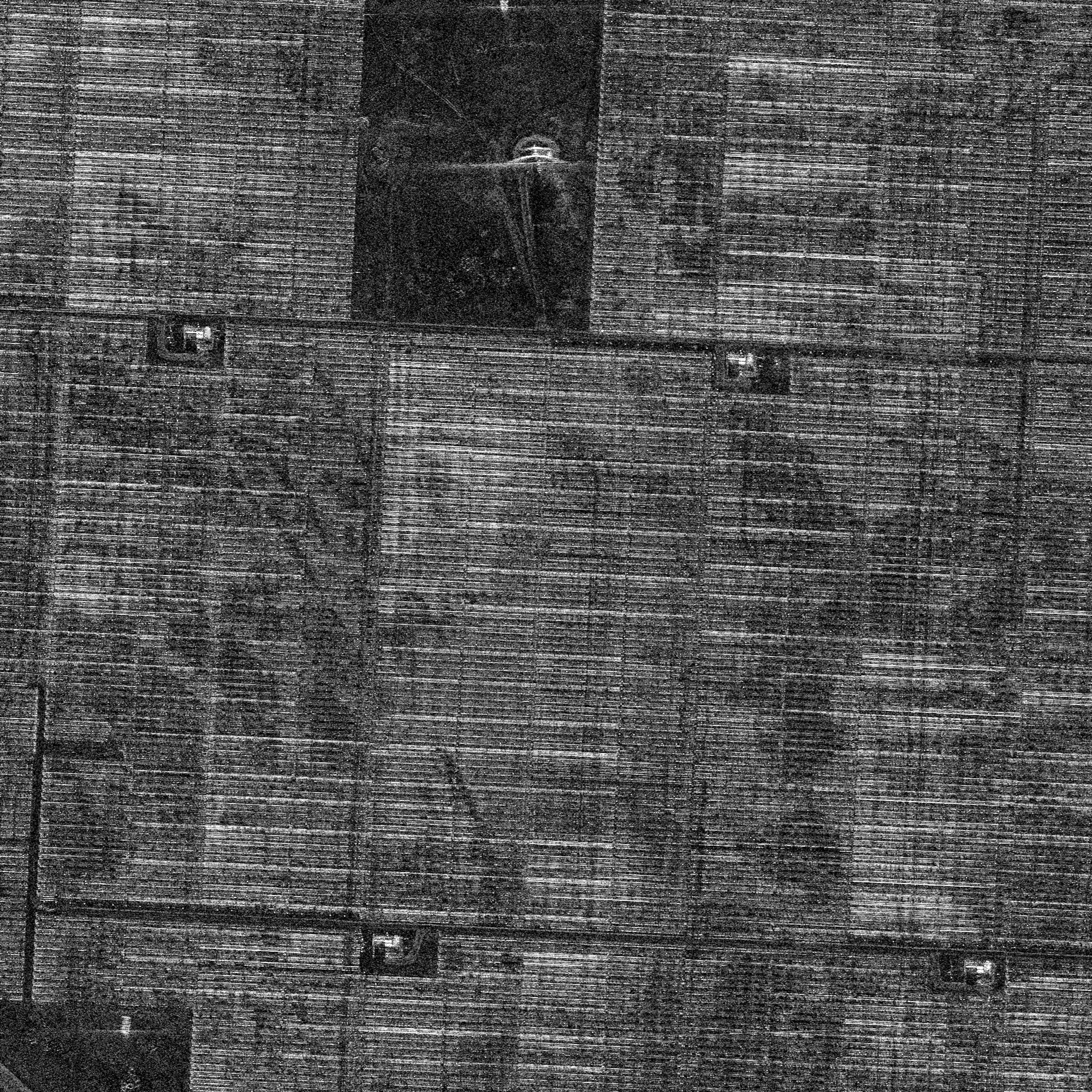
Detail: the north-west corner at 0.35 mUmbra · 8 Nov 2025 · CC BY 4.0
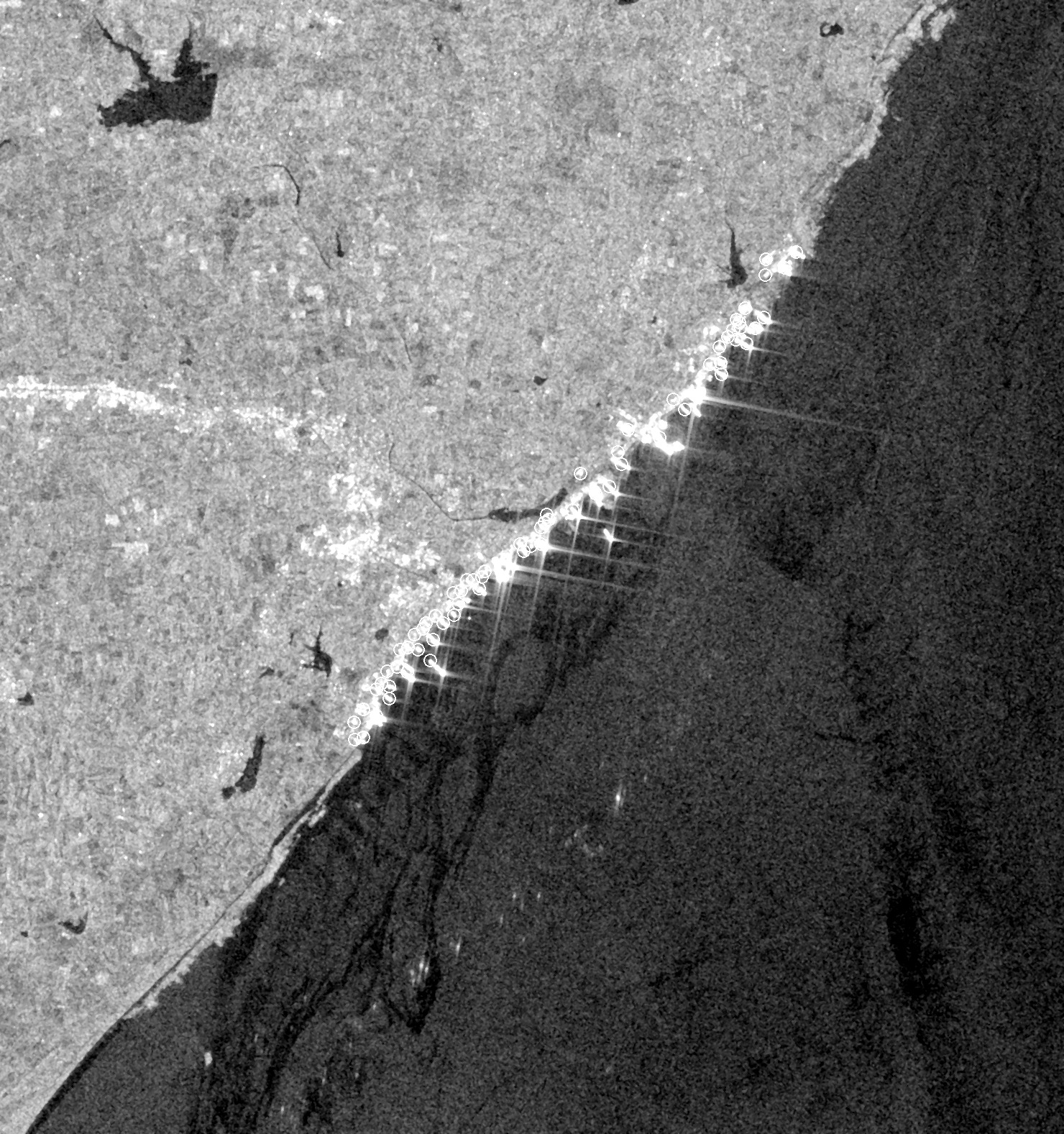
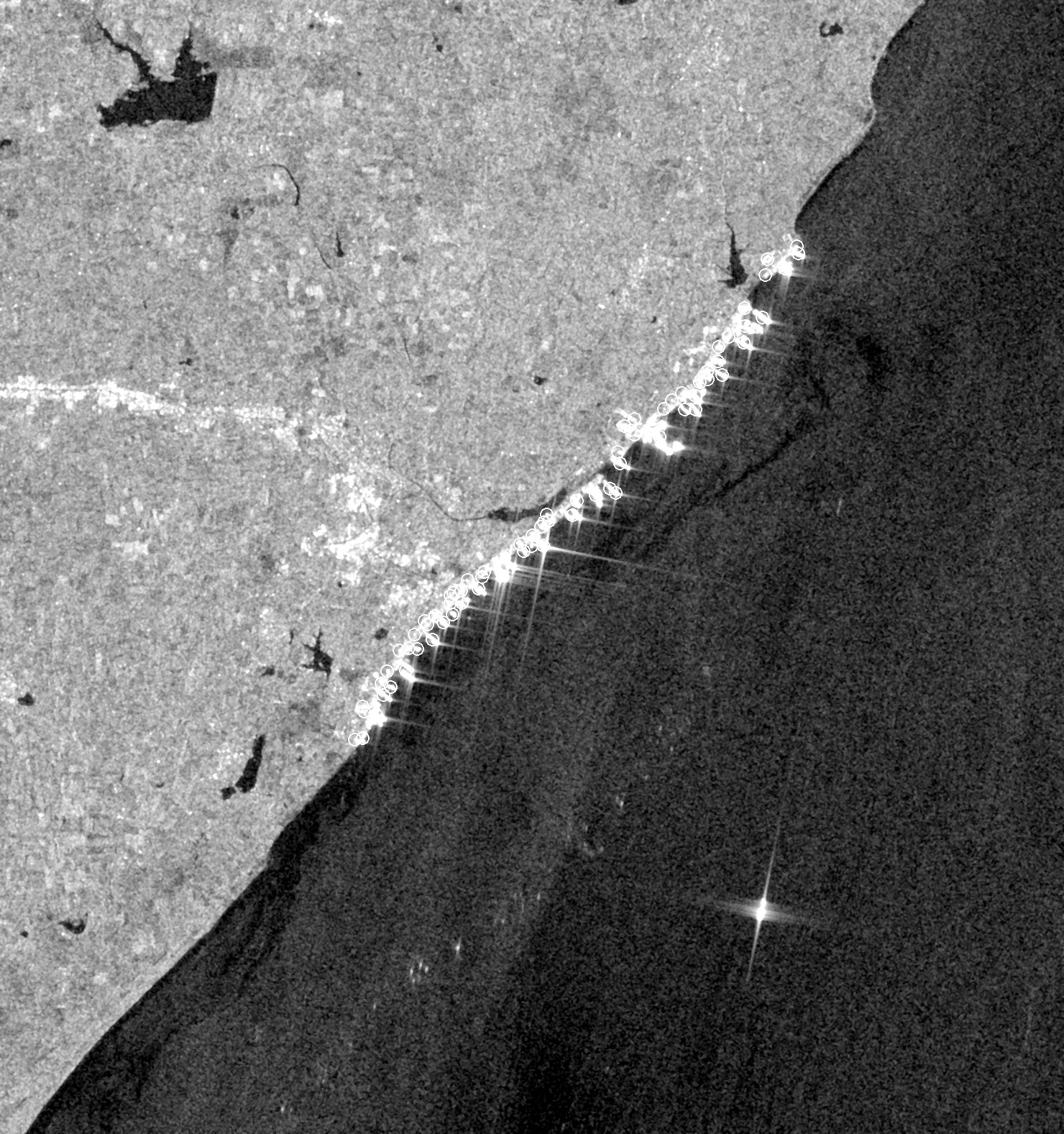
No. 6 · Alang, Gujarat · Sentinel-1 · 10 m · track 34 · 24 October 2026 · 06:32 IST
How many ships are on the beach at Alang?
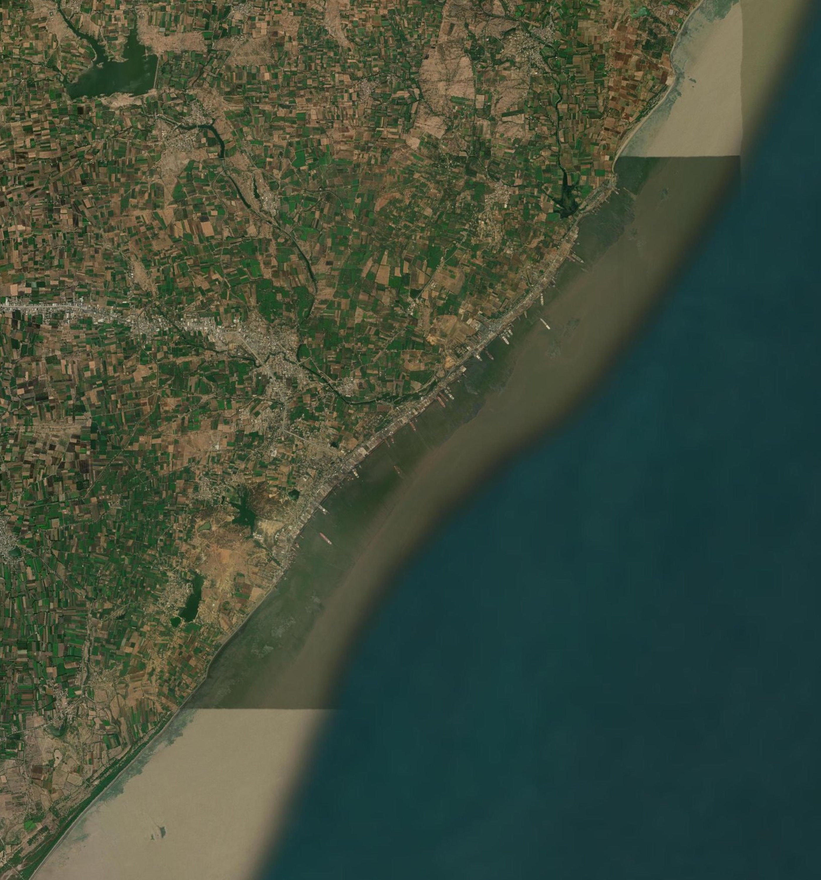
69 bright hulls and hull sections on the breaking beach on 24 October; 73 on 12 October, same track. Every star along the shore is a ship run aground to be cut up, in the open, at one of the world's largest breaking yards.
What is here · optical, Esri World Imagery (Esri, Maxar) · same frame as the radar · orientation only
every pass of track 34 since August; the other track's swath ends before the shoreline here and is not used
A ring is a bright return on the shore strip, not a registered ship: a hull half cut up can read as two, and two hulls side by side as one. What holds is the change from pass to pass. Radar cannot say how much of a hull is left, or whose it was.
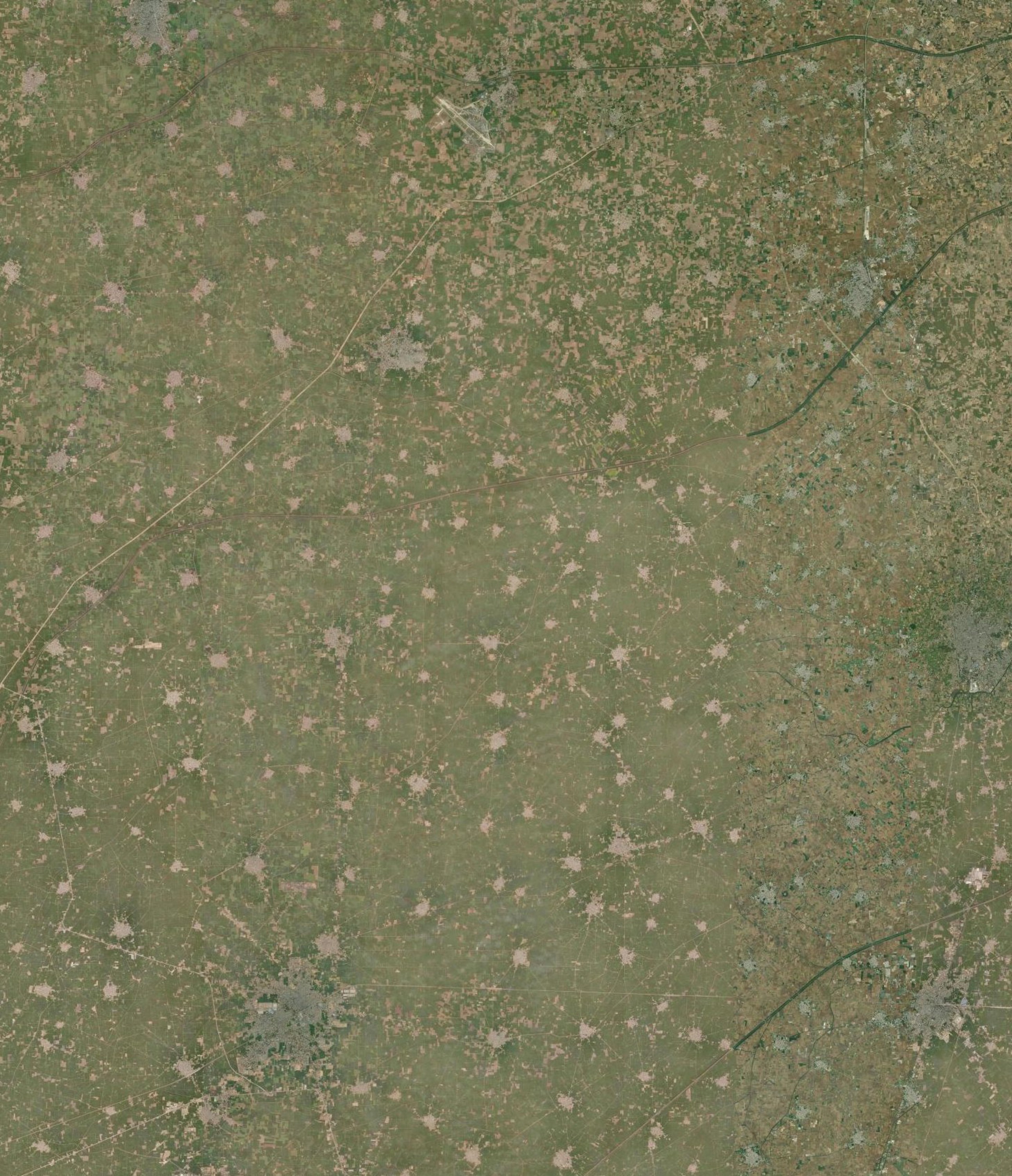
No. 7 · Sangrur–Ludhiana, Punjab · Sentinel-1 · 10 m · track 34 · 26 June 2026 · 06:29 IST
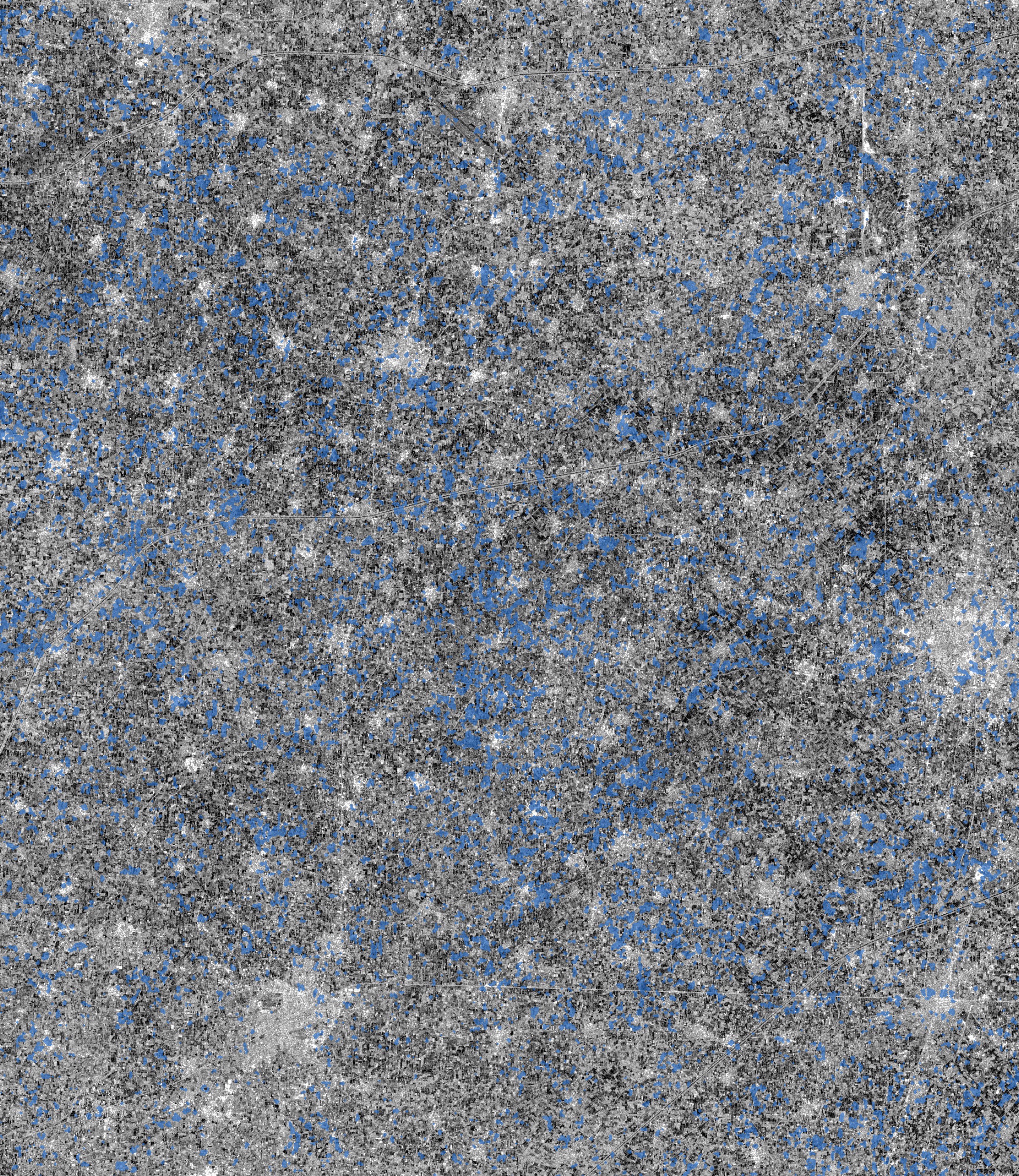
When did Punjab flood its paddy fields?
On 26 June, 272 km² of this block was under water that is not there the rest of the season: one field in ten. It was 3.5 km² on 7 June and 124 on 19 June. By 8 July the young crop covers the water and radar stops seeing it.
What is here · optical, Esri World Imagery (Esri, Maxar) · same frame as the radar · orientation only
km² flooded, every pass of track 34 from June to September; a block of 2,688 km²
Flooded means darker than −15 dB on this pass and not water in the season's median, in patches of field size. Radar sees open water only: once rice covers a field it reads as crop, so the fall after June is the crop growing, not the water going. September's small rise comes after transplanting is over; rain is the likely cause, and radar alone cannot confirm it.
No. 8 · Son river at Nasriganj, Bihar · Sentinel-2 · optical · 10 m · 19 May 2026 · 10:27 IST
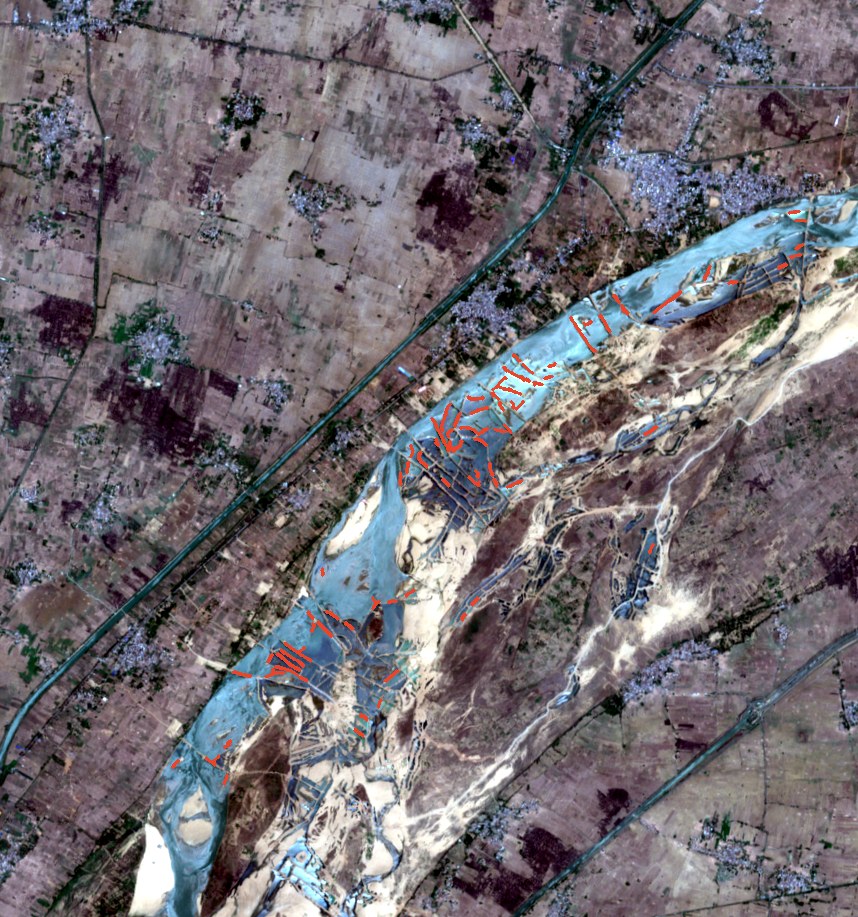
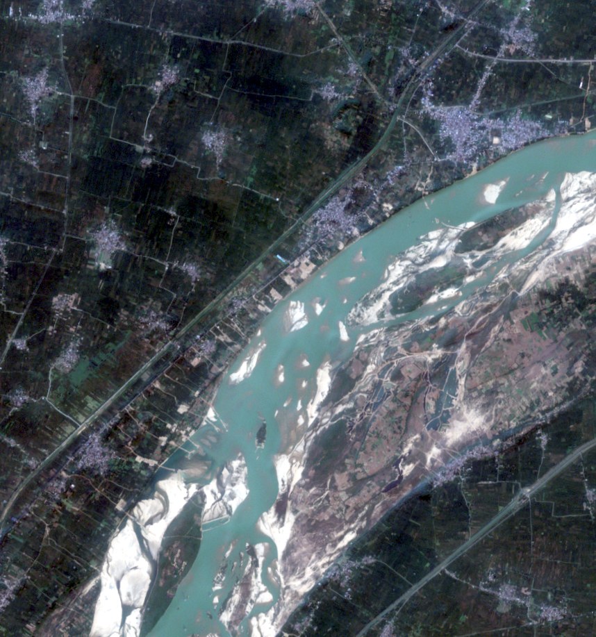
How much of the Son is cut into sand pits?
At least 10.8 km of sand walls stood in the water of this 9 km reach on 19 May, dividing the channel into pits. On 10 November, less than four weeks after Bihar's monsoon ban on mining ended, 1.8 km. The flood erases the walls each year and they are built again: 8.5 km stood here in May 2025.
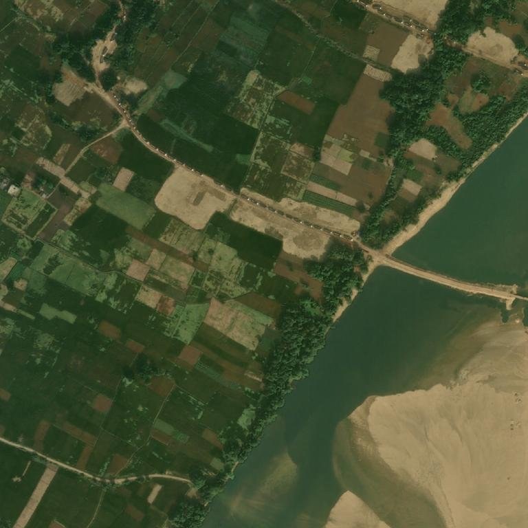
What a wall is · a causeway into the channel, trucks queued on the road to it · Esri World Imagery (Esri, Vantor), captured 17 Nov 2025 · 0.8 km across
km of walls in this frame, one clear pass a month; the monsoon flood resets it
A wall is ground up to 20 m wide and at least 80 m long with water on both sides. Wider walls and dry pits are missed; thin natural bars are counted, so November is not zero. The frame cannot say which pits lie inside a lease: ghats are licensed in this block, and one lease's own assessment says no diversion of the river is proposed. In November 2024 the National Green Tribunal took up a plea that temporary dams from Nasriganj to Tilouthu obstruct the Son, and ordered a fact-finding committee.
No. 9 · Dhordo, Kachchh · Sentinel-2 · optical · 10 m · 21 October 2026 · 11:32 IST
Is the Rann Utsav tent city up yet?
Going up: 5.6 ha of roof stood on the rings at Dhordo on 21 October. A year ago 10.2 ha stood by 24 October; the tents stayed through February and were struck by late March.
What is here off season · the empty rings, tents struck · Esri World Imagery (Esri, Vantor), captured 16 Apr 2026 · 0.8 km across
hectares of roof inside the tent city's footprint, each clear pass
A roof is a 10 m pixel inside the tent city whose colour differs from the bare ground of the off season. A tent smaller than a pixel is missed, so the area is a floor. Last season the festival ran from 23 November to 20 February and the tent city to 4 March; the frame shows the tents standing a month before opening. The booking site gives 1 November 2026 as this season's first day.
On each Sentinel-1 pass we mask water as the median of all passes on that track, then call a hull any patch brighter than −14 dB against the water floor, 2 to 400 pixels at 20 m, and more than 240 m from the coast. A ship alongside a quay merges with it, so every port count is a floor.
Only passes on the same track are compared: a different track sees the same sea from a different angle and the counts move with it.
Building
Two passes of the same track a year apart. Ground that returns the pulse at least 5 dB more strongly than before, is now brighter than −11 dB and was darker than −17 dB (bare land, not water), in patches of 8 pixels or more at 40 m, is called newly built.
Drying lake shores pass the same test, so the shore is read by eye and said so.
Beached hulls, flooded fields, sand walls
Alang: returns brighter than +3 dB inside a 500 m band along the shoreline, each blob one count; only the track whose swath covers the whole beach is used. Paddy: 20 m pixels darker than −15 dB on a pass and not water in the median of the season's passes, speckle removed.
Both are floors on one track; two tracks are never mixed.
The Son: read from optical passes, not radar, because dry sand and calm water are both dark to radar. A wall is ground up to 20 m wide and 80 m or longer with water on both sides, at 10 m; its length is summed for the frame, one clear pass a month.
What radar can't say
What a hull carries, where it is bound, or whose it is.
Whether a new bright block is panels, a substation or a road: only that it is hard and new.
Anything between passes. Sentinel-1 returns to a track every 6 to 12 days.
Copernicus Sentinel-1 and Sentinel-2 via Microsoft Planetary Computer · optical orientation: Esri World Imagery (Esri, Maxar, Earthstar Geographics) · ICEYE open data, scene TECXN4, CC BY 4.0 · Umbra open data, CC BY 4.0 · IMF PortWatch · Ministry of Ports, Shipping and WaterwaysMaplore · maplore.in · 4 October 2026