
Goa in ten questions
Goenche answers one question at a time for Goa's 200 panchayats and towns. Each picture is the map answering it.
1Land
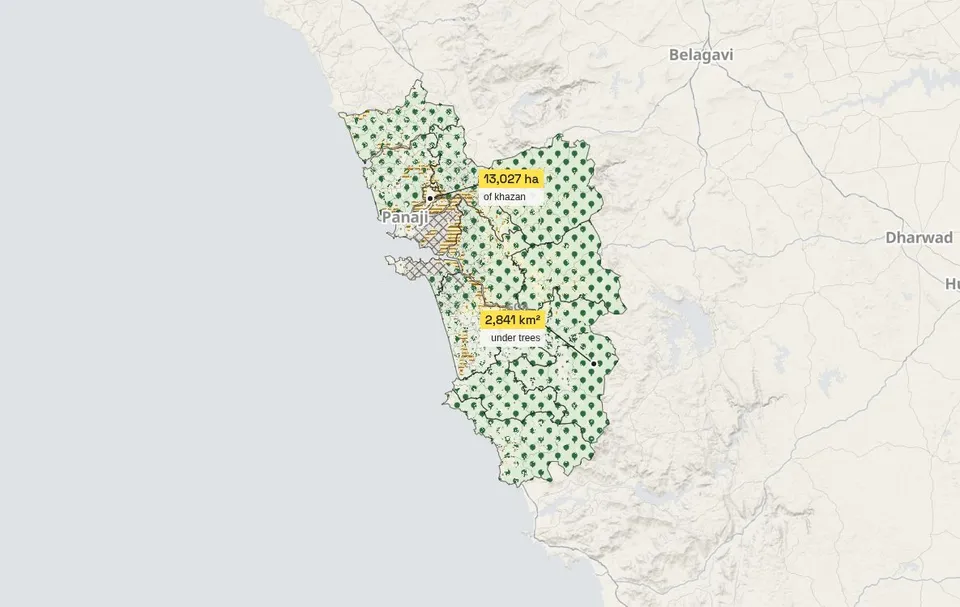
Goa is 3,580 km² in 200 panchayats and towns; 79 % of it is under trees.
ESA WorldCover 2021 · draft Goa CZMP 2019 · boundaries ICAR-NBSS via amche.in
2Trees and carbon
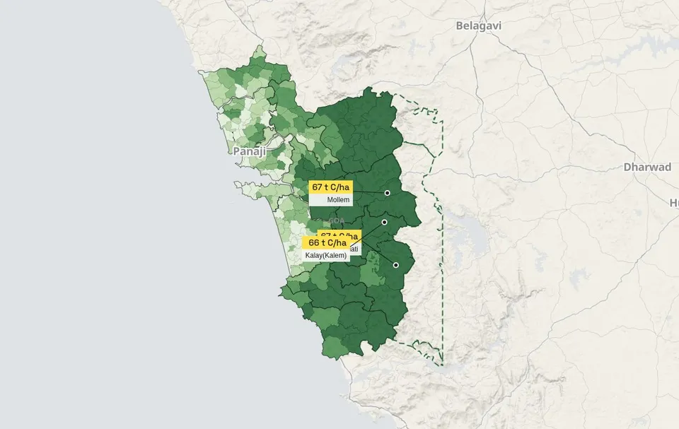
Goa's trees hold about 13.9 million tonnes of carbon; 54 % of it stands in Sanguem, Satari, Dharbandora.
ESA CCI Biomass v7 (2022) × 0.47, an estimate · PM GatiShakti protected areas
3Soil
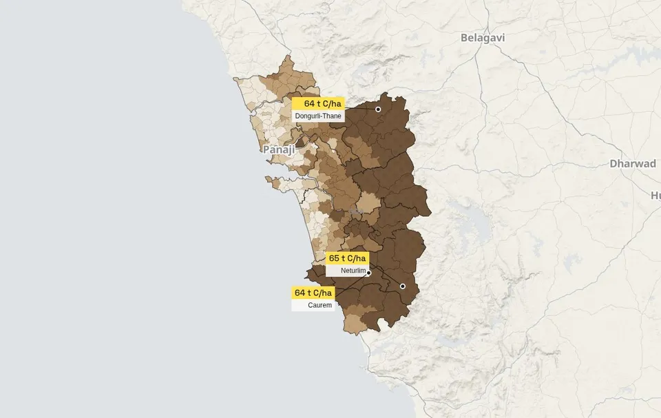
The top 30 cm of soil hold 20.5 million tonnes of carbon, more than all the trees; richest Neturlim, poorest Agarwada Chopdem.
SoilGrids 2.0 (ISRIC, 250 m)
4Khazan and coast
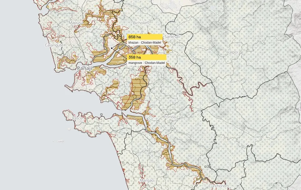
13,027 ha of khazan held behind 566 km of bunds; 146 of 200 local bodies touch the hazard line.
Draft Goa CZMP 2019 (WRD) via amche.in · ESA WorldCover 2021
5Pressure
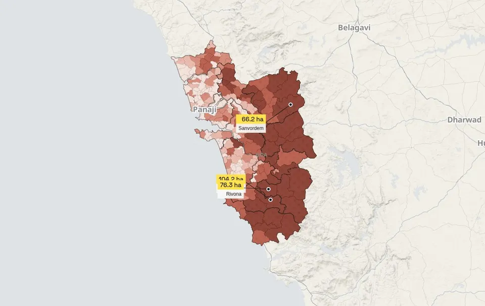
1,756 ha of tree cover lost since 2001; 2 % of Goa is built over.
Hansen/UMD Global Forest Change v1.12 · ESA WorldCover 2021
6Protection
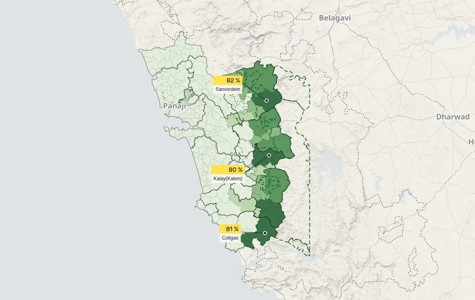
766 km² inside sanctuaries and national parks; the draft eco-sensitive area of 2026 adds more.
PM GatiShakti · MoEFCC draft via amche.in
7Life recorded
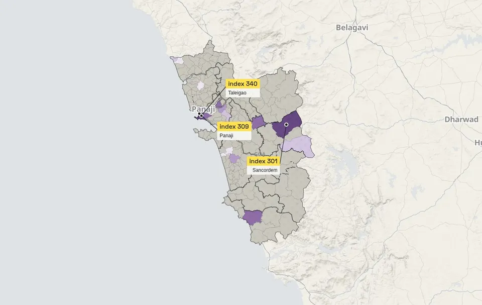
1,982 people have recorded 4,559 wild species in Goa; only 18 of 200 places are surveyed enough to compare.
Recorded by 1,982 observers on iNaturalist · records licensed for reuse, pulled 25 October 2026
8Beaches
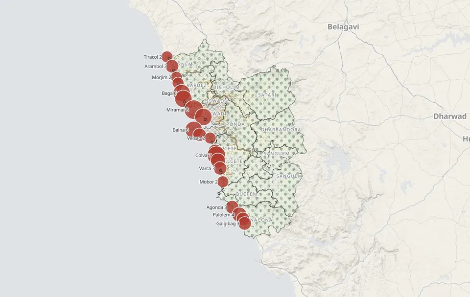
All 20 beaches the pollution board samples broke the bathing limit at least once in 2025-26; Miramar was over it in 8 of 12 monthly samples.
GSPCB water monitoring 2025-26 · lifeguard records 2008-2020 · Department of Tourism · beaches placed from official stations and OpenStreetMap
9Mining
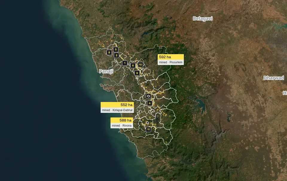
About 6,209 ha of Goa is mapped as mine or quarry, 92 % of it in the 46 places the mining trusts list as affected.
The trusts had sanctioned ₹105.5 crore by April 2026; 28 of those 46 places have no project of their own.
Imagery: Esri, Maxar, Earthstar Geographics · mines: OpenStreetMap contributors · North Goa DMF and Kushavati DMF project reports, April 2026 · dmf.goa.gov.in
10Water in store
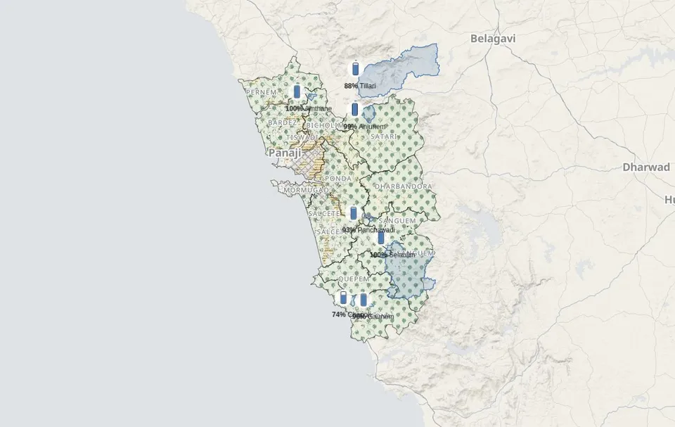
Goa WRD dam levels · GoaWRIS
Pictures taken from the map on 11 October 2026. The sentence under each is the one the map shows today; how every number is measured is on the Method page.